The Falkland Islands are a remote archipelago in the South Atlantic Ocean. This British Overseas Territory lies hundreds of kilometers east of South America, giving it a unique location and history.
The islands are famous for their wildlife (especially penguins) and their role in the 1982 Falklands War. In this article we’ll explore the Falkland Islands’ location, geography, and key facts, using short paragraphs and clear language.
Where is the Falkland Islands located? – Geographical Location of Falkland Islands
The Falkland Islands occupy a very remote spot in the South Atlantic. The map above highlights how isolated they are from other landmasses. They lie about 480 km (300 miles) east of Argentina’s southern coast, roughly opposite the tip of Patagonia. In fact, the islands sit between latitudes 51°S and 53°S on the Patagonian Shelf.
This places them at about the same southern latitude as London is in the northern hemisphere. The two main landmasses – East Falkland and West Falkland – are separated by a 20-km wide channel called Falkland Sound, and hundreds of smaller islets lie scattered around them.
Key facts about the Falklands’ geography include:
- Position: About 300 mi (480 km) east of the southern tip of South America.
- Coordinates: Roughly 51°–53° S and 57°–61° W (on the Patagonian Shelf).
- Archipelago: Two large islands (East and West Falkland) plus over 700 smaller ones.
- Size: Total land area ≈12,200 km² (4,700 sq mi).
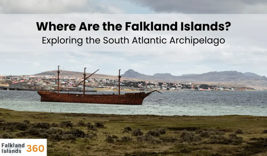
- Capital: Stanley (on East Falkland), where about four-fifths of the population lives.
Nearby countries include Argentina (the closest, with the Falklands some 480 km east of its coast) and Chile (across Tierra del Fuego and the Strait of Magellan to the west). On the map of South America, the Falklands appear almost due east of the southern tip of Chile/Argentina. Their isolated South Atlantic location means the islands have strong maritime influences and share climatic similarities with far northern lands.
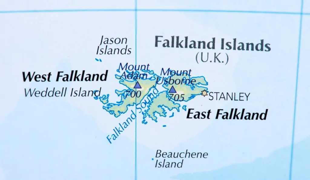
Map Overview of Falkland Islands
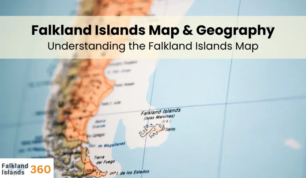
A typical Falkland Islands map highlights the two main islands and their surroundings. In the topographic map above, East Falkland is on the right (east) and West Falkland on the left (west). You can see the capital Stanley on East Falkland, plus notable features like Falkland Sound (the channel between the islands) and mountain ranges (for example, Wickham Heights on East Falkland peaks at over 700 m).
The map’s labels also mark smaller groups like the Jason Islands to the northwest. Surrounding the land, the South Atlantic Ocean is shown with scale bars and coordinates (lines of latitude ~51°–53° S and longitude ~59° W). Some maps include an inset or annotation indicating that the Falklands lie off the coast of southern Argentina.
Key map features often include:
- Main islands: East and West Falkland are clearly labeled, with their shapes and relative sizes.
- Capital: Stanley is marked on East Falkland; the RAF base at Mount Pleasant (35 mi southwest of Stanley) is sometimes noted.
- Geographic labels: Bays (San Carlos Water, Grantham Sound), mountains (e.g. Mount Usborne), and small island names (Saunders, Beauchene, etc.) are usually shown.
- Surrounding waters: The Atlantic and nearby features like the Strait of Magellan (far west) are contextually placed.
Such Falkland Islands maps give a clear visual of the archipelago’s layout and location. They remind readers how the islands are spread out in the ocean, far from major continents, which contributes to their distinct climate and ecology.
Climate and Environment
The Falkland Islands have a cool, oceanic climate. The surrounding Southern Ocean and Antarctic waters keep temperatures moderate: it almost never gets very hot or very cold. In fact, the islands’ temperature range is quite narrow – rarely above 24 °C or below –5 °C. The annual average temperature is only about 5 °C.
Summers are cool (mean highs ~13 °C in January) and winters are cold (mean highs ~4 °C in July). Rainfall is fairly low (around 570 mm per year on average), and strong westerly winds and clouds are common. Snow falls occasionally but usually does not accumulate. Overall, the climate is often described as similar to northeast Scotland – cool, windy and damp, without extreme seasons.
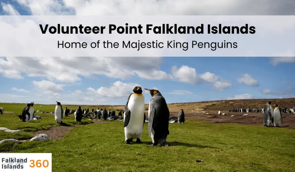
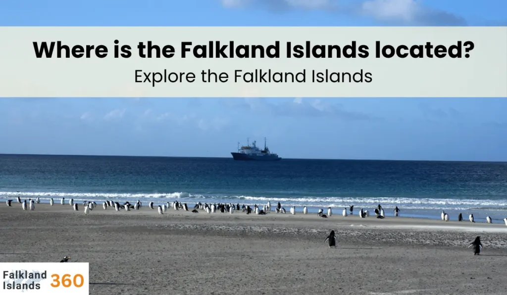
Despite the chilly weather, the Falklands are rich in wildlife. The islands are famous for their seabird colonies and marine mammals. There are no native trees – the land is covered by low grasses and shrubs. Coastal tussac grass grows in thick clumps, providing micro-habitats for birds. In total about 65 bird species live or breed here. Most famously, the Falklands are breeding grounds for millions of penguins – chiefly rockhopper, Magellanic and gentoo penguins, with smaller colonies of king and macaroni penguins. (The photo above shows one of the king penguins found on West Falkland.)
Other birdlife includes albatrosses, Falkland steamer ducks, caracaras and the endemic Falkland pipit. In the surrounding seas and shores, marine mammals abound: dolphins, porpoises, fur seals, sea lions and elephant seals are commonly seen. (In fact, three species of earless seals breed on the islands.) These Falkland Islands facts about wildlife highlight how the remote, oceanic location creates a rich but fragile environment.
Cultural and Historical Context
Human history on the Falklands is relatively recent, beginning in the 18th century. The first known settlement was by the French in 1764, on East Falkland, followed by a British settlement on West Falkland in 1765. Soon after, Spain took over the French colony (1770) and expelled the British, but Britain regained control in 1771. After Argentina’s independence, Buenos Aires declared sovereignty in 1820, but the British re-established permanent control in 1833. In local usage today, the islands are often called Islas Malvinas (the Spanish name), a legacy of early French and Spanish naming.
Most Falkland Islanders today are of British descent and English-speaking. The population is small (around 3,000) and lives mainly in towns or farming communities. In fact, sheep ranching has long been the economic backbone of the islands. Culturally, the islands maintain British institutions (flag, postage stamps, education) while being geographically isolated. The Falklands War of 1982 is a key historical event tied to location: Argentina invaded the islands (lying ~300 mi off its coast) and a brief conflict ensued before Britain reclaimed them. This history underscores why understanding the islands’ precise location is important – it explains their strategic significance and why they remain a point of international interest.
Conclusion
In summary, the Falkland Islands are an archipelago of over 700 islands located in the southwestern Atlantic Ocean, a few hundred miles off the coast of South America. Their remote position (around 52°S latitude) shapes everything from their cool maritime climate to their abundant wildlife. Knowing the Falkland Islands location helps explain why they have no native forests, how they came to be a British territory, and what makes their map and geography unique.
We encourage readers to explore a Falkland Islands map and learn more Falkland Islands facts – for instance, about Stanley’s history or the various wildlife preserves. Whether for travel or general knowledge, understanding where the Falkland Islands sit on the globe is the first step in appreciating this remarkable and distant land.